Viaduct Elegy is a four-part series from Automoblog feature columnist Tony Borroz, who broke the law in preparation for writing it. He is a Seattle native and author of The 2018 Indy 500 Notebook and Bricks & Bones: The Endearing Legacy and Nitty-Gritty Phenomenon of The Indy 500, available in paperback or Kindle format. Tony grew up in a sportscar-oriented family, but sadly, they were British cars.
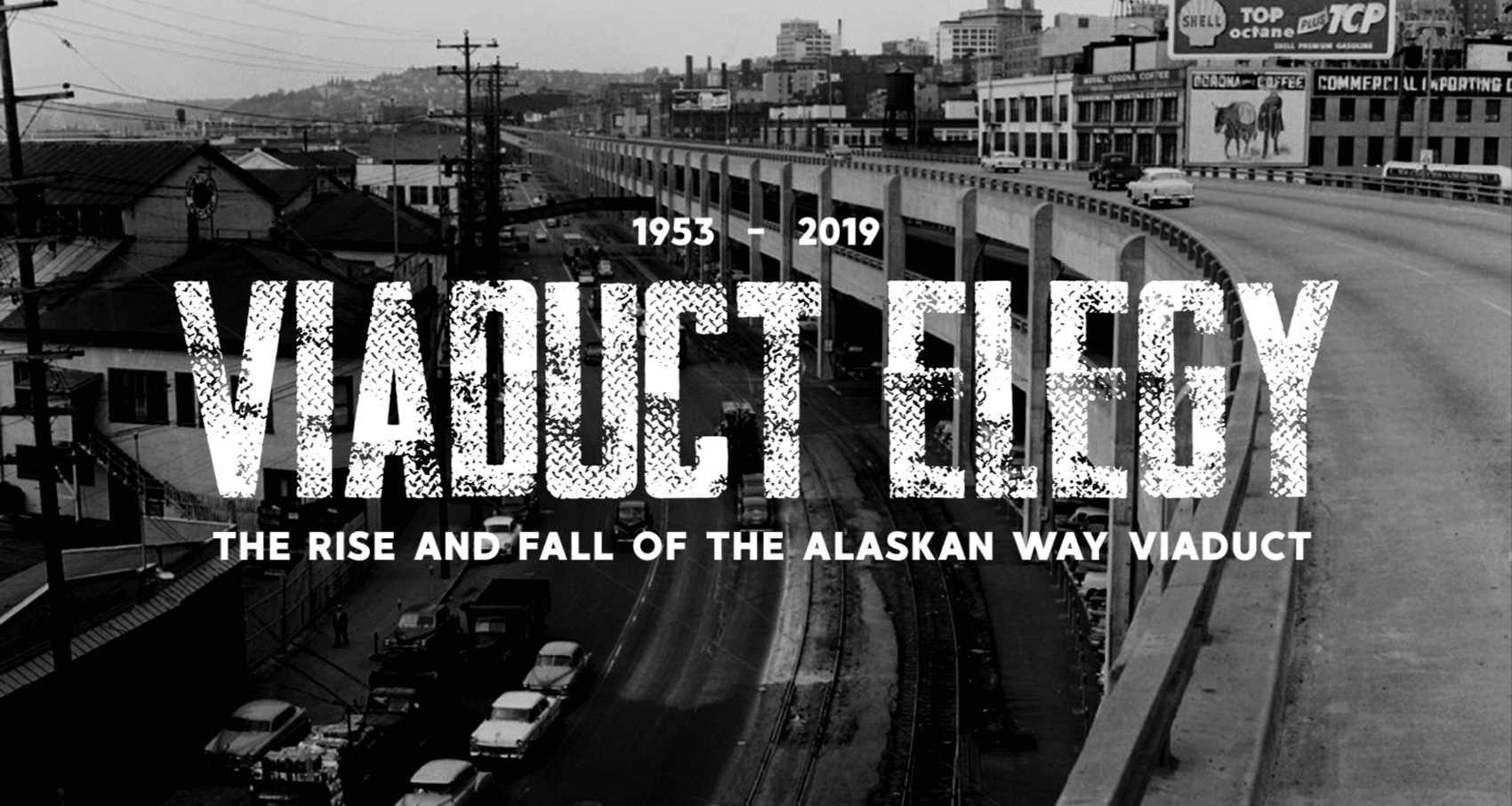
Finally, finally, finally they are tearing down the Alaskan Way Viaduct, a colossal, monumentally-ugly, seismically-catastrophic piece of transportation “infrastructure” that has been a scar on the face of Seattle for the better part of a friggin’ century.
And yesterday I walked on it at sunset with an old friend, apparently breaking the law.
Chapter One: “Walking With Blaine” here.
Chapter Two: “The New Colossus” here.
And Chapter Three: “Streamlined Brutale” here.
Viaduct Elegy: Chapter 4: A Disaster Waiting to Happen
. . . and then one day, in a sainted land by The Bay, the Earth began to shake.
The 1989 Loma Prieta earthquake flattened the Cypress Street Viaduct in Oakland, California and killed 42 people in the process. I heard the same people who designed and built the Cypress Street Viaduct in Oakland were the same people who made the Embarcadero Freeway in San Francisco and The Alaskan Way Viaduct in Seattle.
San Francisco glanced across The Bay, took one look at the smoking rubble that used to be the Cypress Street Viaduct in Oakland and said, “Right. We’re tearing ours down.” And they did. In eleven months, the San Francisco version of The Viaduct was completely removed. A bright, sunny, broad concourse of streets called The Embarcadero took its place.
Ring of Fire
And here we are in Seattle, thirty years later, and The Alaskan Way Viaduct is still standing. This, this right here, is why Seattle is still a backwater town run by greedy rubes. San Francisco saw an immediate and clear danger to its citizens and took care of it in less than a year. Seattle had the same situation, almost the exact same situation, and it took them three decades to come up with a “solution.”
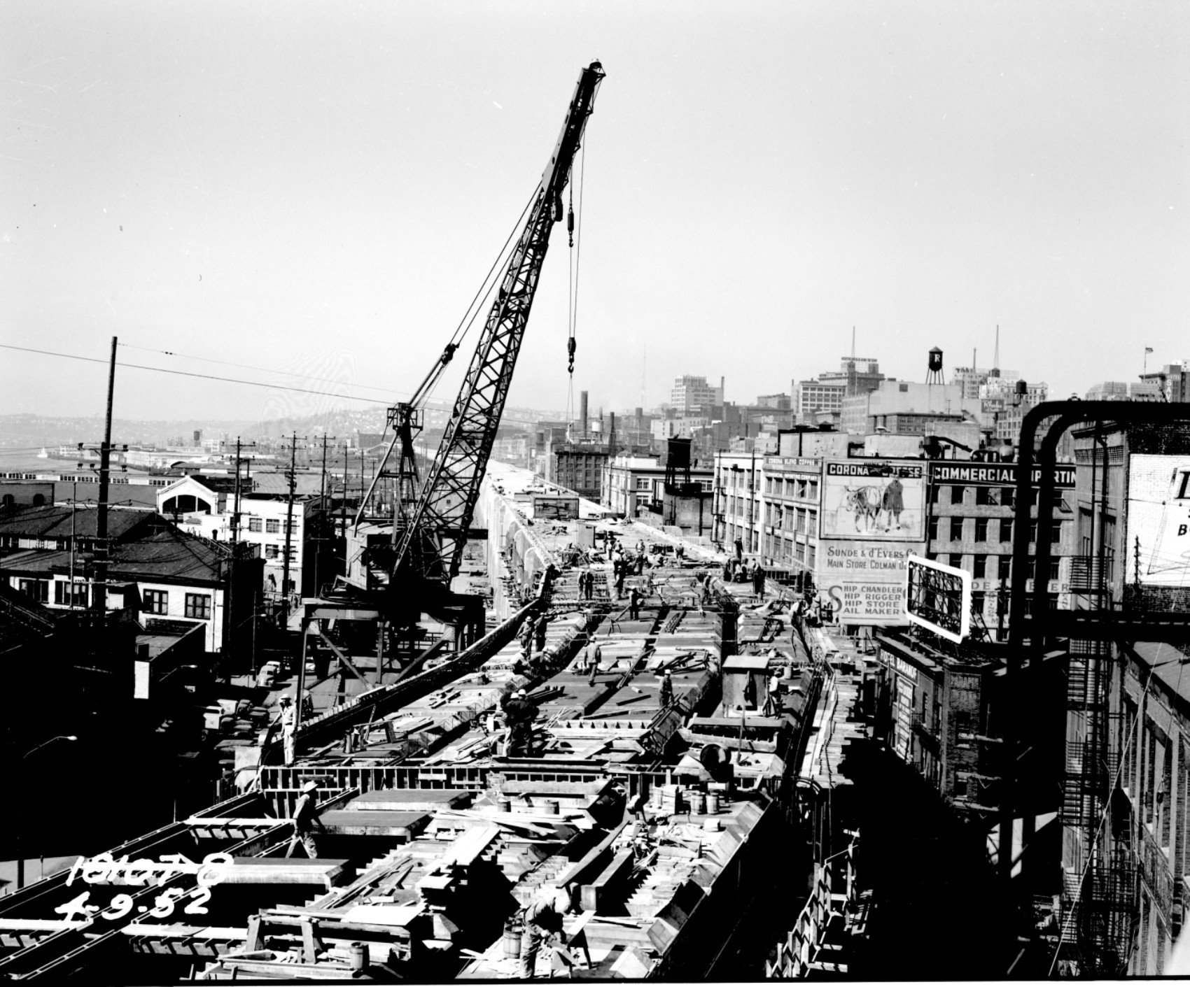
No wait, Seattle had it worse. Have I mentioned The Viaduct is built on a landfill? I didn’t mention it, and it is. The entire old downtown (Pioneer Square) of Seattle sits on rubble, jacked up 15 feet from the original ground level. It was a drainage and sewer problem that inspired a story of greed, willful stupidity, ineptitude, and poor planning. Known to be a sure-fire, bullseye of a bad deal in an earthquake from the start, Seattle still built and kept a seismically unstable roadway functioning for thirty years.
Seattle sits right on top of the third worst earthquake zone in the Pacific Rim of Fire. Tokyo and the Japanese home islands are number one. Los Angeles and San Francisco are tied for 2nd place (although it could be said that SF is worse, since it is directly on top of the San Andreas fault). And then there’s Seattle and the entirety of Puget Sound. The only thing that makes this surprising to some people (even the citizens and city planners of Seattle) is that quakes don’t happen all that frequently around here. That’s actually worse, from a seismic perspective.
And it is especially bad for Seattle, the downtown waterfront, and Pioneer Square in particular.
Day After Tomorrow
When the big one hits – and we haven’t even had a minor one for two decades – a major portion of one of the largest cities on the west coast will be razed from the face of the Earth. Flattened. No two ways about it; it’s not even up for debate. Pioneer Square is mostly unreinforced masonry and brick buildings, perched 15 feet above the real ground level. Our entire waterfront, from the Port of Seattle to Battery Street, is landfill. The big one will hit. The ground will liquefy. Like a massive vacuum, the waterfront will drop ten feet or so. The seawall will collapse and Puget Sound will pour in. Pioneer Square, as a whole, will shift back to its original street level nearly instantaneously.
And that’s when the brick walls will collapse.
This whole process will take less than a minute and will, effectively, level around 30 city blocks at a stroke.
It will be bad. It could, conceivably, stop Seattle from functioning as a city, for more than a year. Maybe even longer.
As far as The Viaduct is concerned, Seattle thinks it has this problem solved. Whereas both of those other little towns, Oakland and San Francisco, solved their problems within months, Seattle, after much thought, careful consideration and many, many studies came up with their solution three decades later: a tunnel!
That’s right.
Seattle Squeeze
Taking inspiration from Boston’s “Big Dig” (no, really) Seattle thought the best way to remove The Viaduct yet keep a north/south route was to bore a tunnel through the landfill. Whereas San Francisco made a broad, airy, sun-drenched Embarcadero that effortlessly caters to walkers and bikers and cars and trucks and light rail within a year, Seattle decided the better option was to make a tunnel that can accommodate four lanes of traffic. Four.
For the secondary north/south route in one of the most congested cities in the country.
Oh, and it will be a toll road too! They are going to charge you to drive this new tunnel roadway. And here’s the kicker: “This will not adversely affect surface traffic,” they claim. Seattle, after thirty years of screwing around with this, will drop the available lanes from six to four, charge you, then has the nerve to say traffic will actually improve for the entire region.
Imagine if your boss said, “We’re cutting your pay, and we’re charging you to cash your paycheck now, but don’t worry! It’ll actually be better for you!”
Ivory Towers
I was thinking over all of this – the design, the building, the maintenance, the modifications, the slow death of the road itself, the ugliness, the rampant greed and stupidity, all of it – as I walked over the crumbling road surface one sunny, January day. I lifted my eyes from a pothole the size of a toilet and looked up; up to a group watching us from high above on the balcony of their multi-million dollar condo in a new, repulsive building that wasn’t there a few years ago.
“This is all their fault,” I jokingly said to Blaine, pointing upward.
He laughed that same rueful laugh that all Seattleites have been laughing since the second boat of colonizers showed up.
“Yeah . . . sunset’s nice though.”
Follow Tony Borroz on Twitter: @TonyBorroz. For more historic photos of the Alaskan Way Viaduct and the city of Seattle, visit the Seattle Municipal Archive’s Flickr page.